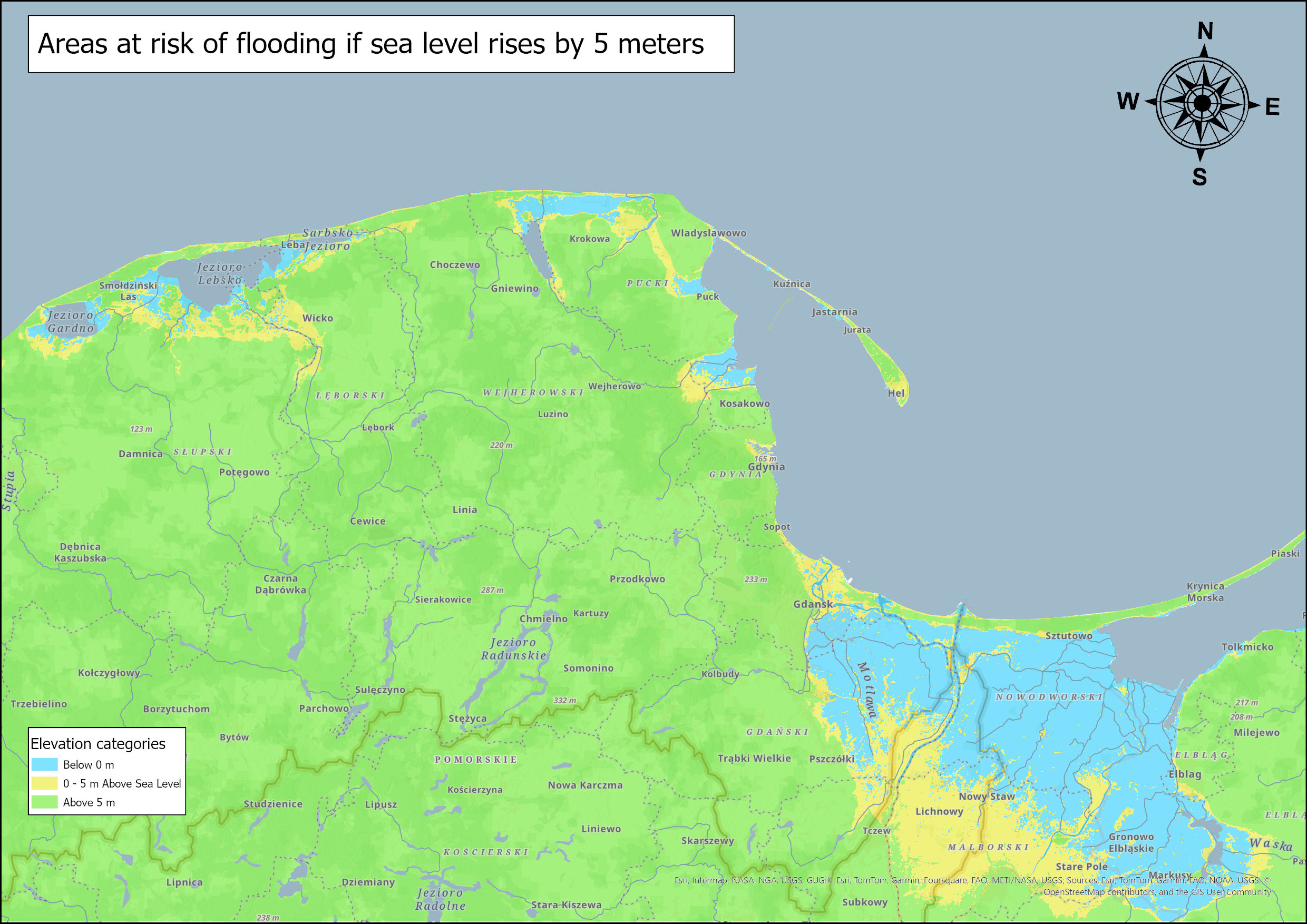
This analysis estimates the population at risk in coastal areas of Poland vulnerable to flooding from a potential 5-meter sea level rise. Using GIS techniques and elevation data, the project identifies vulnerable zones and calculates affected populations.
Methodology
The analysis was conducted using the following workflow:
- Data Acquisition:
- European Digital Elevation Model (EU-DEM) v1.1 from Copernicus Land Monitoring Service
- Global Human Settlement Layer (population density data) from JRC
- Data Processing:
- Projected data to WGS 1984 UTM Zone 34N coordinate system
- Clipped to study area extent
- Analysis:
- Identified land areas below 0m elevation (current sea level)
- Identified areas below 5m elevation (potential flood zone)
- Combined elevation classes to create risk zones
- Calculated population statistics for each zone
Key Findings
The analysis reveals significant population vulnerability to sea level rise:
- Areas currently below sea level (depressions) contain 104,333 inhabitants
- Areas between 0-5m elevation contain 209,303 inhabitants
- Total population at risk from 5m sea level rise: 313,636 people